Northwest Boundary Dike
National Register Listing
Street Address:
Address Restricted (Richland County)
NRHP Nomination
Record Number:
S10817740121
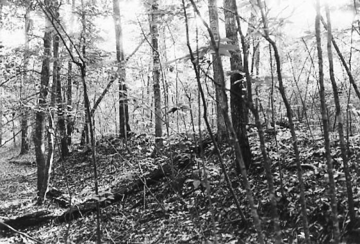
Description and Narrative:
The Northwest Boundary Dike is significant for its association with the agricultural settlement of the Congaree Swamp and for its ability to yield information about settlement patterns in the region. James Adams constructed the dike on a 4,000-acre parcel of land granted to him in 1839. By building the dike, he sought to control the periodic flooding of the Congaree River in order to utilize the fertile swampland on its border to grow crops. Following his death in 1841, his family chose not to continue the dike project and the structure remained unfinished. It is an approximately 10-to-30-foot-wide-by-5-foot-high earthen dike running north to south for approximately 2000 feet. The length of the dike is broken in several places by gaps caused by erosion and inundation. The structure is covered with mature hardwood trees, many dated up to 150 years old, and other vegetation. Listed in the National Register November 25, 1996.
Period of Significance:
1740 – 1900
Level of Significance:
Local
Area of Significance:
Agriculture;Archeology: Historic - Non-Aboriginal
National Register Determination:
listed
Date of Certification:
November 25 1996