Bridge Abutments
National Register Listing
Street Address:
Address Restricted (Richland County)
NRHP Nomination
Record Number:
S10817740115
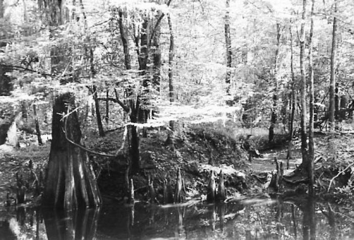
Description and Narrative:
The Bridge Abutments are significant for their ability to yield information about settlement patterns in the region. Beginning in 1730, small farmers moved into the backcountry of South Carolina to find fertile farmland and to create “buffer zones” between the backcountry and the heavy coastal settlement centered around the city of Charleston. After the end of the Cherokee War in 1761 and the establishment of the state capital at Columbia in 1786, wealthy planters moved into the Congaree River valley to introduce the plantation system to the region. Utilizing existing Native American trading paths, settlers built roads and ferries across the swamp to provide a means of transporting produce and livestock to markets in cities such as Charleston. These four pair of earthen abutments may be the remains of a bridge associated with a road and ferry system constructed by Isaac Huger in the 1780s. The abutments vary in size from 5-to10-feet high and 10-to-15-feet wide. Wood structural bridge ties are extant on the southernmost set of abutments. Listed in the National Register November 25, 1996.
Level of Significance:
Local
Area of Significance:
Transportation;Archeology: Historic - Non-Aboriginal
National Register Determination:
listed
Date of Certification:
November 25 1996