North Carolina-South Carolina Cornerstone
National Register Listing
Street Address:
Off US 521, Lancaster, SC City Vicinity (Lancaster County)
NRHP Nomination
Record Number:
S10817729010
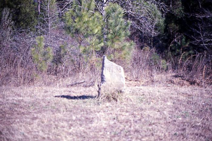
Description and Narrative:
The North Carolina-South Carolina Cornerstone is located on the boundary between Lancaster County, South Carolina and Union County, North Carolina. Disputes over the boundary between North Carolina and South Carolina arose as early as 1730 and continued until 1815. The cornerstone was erected by commissioners appointed by the two states to survey the boundary between the western termination of the boundary line which had been run in 1764 and to the southeast corner of Catawba lands. Confusion had long existed about this section of the boundary between the two states, which is also a part of the present boundary of Lancaster County. As a result, confusion over political jurisdiction had arisen. The North Carolina-South Carolina Cornerstone represents an important settlement in the lengthy boundary dispute between the two state governments. The cornerstone is an uneven, rectangular, upright stone marker approximately two feet high. It was erected in 1813. The stone is of the class metamorphosed igneous and is of local origin. The top part of the cornerstone, which contains the engraved notations, “N.C.” and “S.C.” was broken off when a car hit the marker in 1977. On the portion of the stone remaining at the original site can be seen “A.D. 1818.” Listed in the National Register December 20, 1984.
Period of Significance:
1813
Level of Significance:
State
Area of Significance:
Politics/Government
National Register Determination:
listed
Date of Certification:
December 20 1984