Alexander Bache US Coast Survey Line
National Register Listing
Street Address:
Edisto Island (Charleston County)
NRHP Nomination
Record Number:
S10817710182
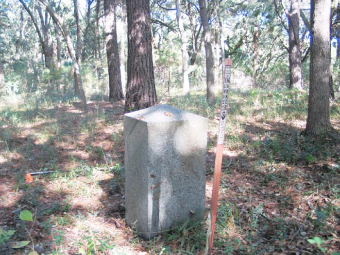
Description and Narrative:
The Alexander Bache U.S. Coast Survey Line is significant for its role in improving the navigation of U.S. waterways. As part of the geodetic survey in America, this base line is representative of the most advanced scientific methods available in 1850. Alexander Dallas Bache and his assistants worked thirteen days in January of 1850 to measure the line, which is approximately six and two-thirds miles long. When they completed the line, they buried granite blocks at each endpoint and then placed a granite monument on top of each block. They also placed blocks of granite in the ground to mark the end of each mile of the line. In the early 1800s, the U.S. government began the U.S. Coast Survey to chart the waterways of the United States with the goal of improving navigation and consequently spurring the economy that greatly depended upon maritime travel. The coast survey extended along the entire Atlantic coastline, as well as the Gulf and Pacific shores. President John Tyler appointed Alexander Bache, the great-grandson of Benjamin Franklin, as the second superintendent of the U.S. Coast Survey of December 11, 1843 following the death of Superintendent Ferdinand Rudolph Hassler. Bache held the position until his death in 1867. Listed in the National Register October 5, 2007.
Period of Significance:
1850;January 3 – 18 1850
Level of Significance:
National
Area of Significance:
Commerce;Maritime History;Transportation
National Register Determination:
listed
Date of Certification:
October 5 2007