Cherokee Path, Sterling Land Grant
National Register Listing
Street Address:
5 mi. SE of St. Matthews on SC 6 (Calhoun County)
NRHP Nomination
Record Number:
S10817709006
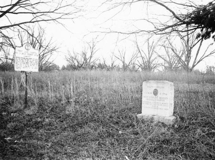
Description and Narrative:
In 1704, George Sterling received a proprietary land grant for 570 acres of land along Ox Creek (today called Lyon’s Creek). It was in an unpopulated section of South Carolina, and Sterling became one of the area’s first white settlers in what was to become Orangeburg District and later Calhoun County. Sterling died in 1706, but his daughter Mary Russell and her husband Charles built a plantation along Ox Creek. Unfortunately no records indicate the exact location of the house or its date of destruction. This plantation was often a stopping place for Native Americans and other travelers along the Cherokee Path, an important Native American trading route that crossed Sterling’s land. Originally, the Cherokee Path was an Indian footpath leading from Charles Towne to the Cherokee territory in South Carolina, across the Appalachian Mountains, and into the valley of the Little Tennessee River. As white settlers began to develop a more extensive trade with the Indians, the Path developed into a larger trading path. The Cherokee Path crosses the entire state of South Carolina, and many modern highways, most notably I-26, follow the route of the Path. Calhoun County is one of the few counties in the state where portions of the original path remain visible. Two acres, crossed by the Cherokee Path, is the portion of the Sterling land nominated to the Register. The site of the grant itself is a deserted, overgrown field which is dotted with scattered trees. Listed in the National Register May 13, 1976.
Period of Significance:
18th century;1704
Level of Significance:
State
Area of Significance:
Transportation;Exploration/Settlement
National Register Determination:
listed
Date of Certification:
May 13 1976