Calais Milestones
National Register Listing
Street Address:
S.C. Sec. Rds. 98 & 44, Cainhoy vicinity (Berkeley County)
NRHP Nomination
Record Number:
S10817708002
Description and Narrative:
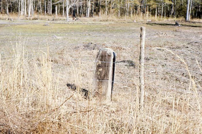
The Calais Milestones marked the distance along the stagecoach road to the Calais-Dover Ferry. The ferry, operating between Calais Ferry House on Daniel Island in Berkeley County and Dover Ferry House just outside the City of Charleston, was established in 1793 by John Clement. Four stones are known to remain marking miles 12, 22, 23, and 26. The age of the milestones is a matter of speculation - three of the stones are believed to be 19th century markers, and one is believed to be an 18th century marker. The location of the highway seems to have changed to its present location in 1825 and it is assumed that these stones would have been placed in their present location at that time. The stones are approximately 8 feet long, with 2 ½ feet exposed above ground and are made of some sort of schist. The tops are rounded from side to side with smooth bevels on the edges. The back is relatively rough. The stones are unadorned or inscribed except near the top where each reads “__ to Calais.” Listed in the National Register March 14, 1973. Removed from the National Register December 8, 2005.
Period of Significance:
1783 – 1790;18th century;19th century
Level of Significance:
State
Area of Significance:
Transportation
National Register Determination:
removed from National Register
Date of Certification:
March 14 1973
Date of Removal from the Register:
December 8 2005